
Thank you for supporting this site ❤️
Make a donation
Make a donation
Dhaula Kuan topographic map
Click on the map to display elevation.
Thank you for supporting this site ❤️
Make a donation
Make a donation
About this map
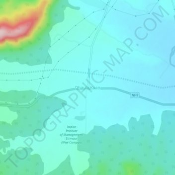
Name: Dhaula Kuan topographic map, elevation, terrain.
Location: Dhaula Kuan, Paonta Sahib, Sirmaur, Himachal Pradesh, India (30.48225 77.45377 30.52225 77.49377)
Average elevation: 470 m
Minimum elevation: 427 m
Maximum elevation: 720 m
Thank you for supporting this site ❤️
Make a donation
Make a donation