
Thank you for supporting this site ❤️
Make a donation
Make a donation
Bhotechaur topographic map
Click on the map to display elevation.
Thank you for supporting this site ❤️
Make a donation
Make a donation
About this map
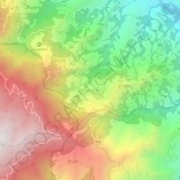
Name: Bhotechaur topographic map, elevation, terrain.
Location: Bhotechaur, Melamchi, Sindhupalchowk, Bagamati Province, Nepal (27.77062 85.47444 27.81062 85.51444)
Average elevation: 1,662 m
Minimum elevation: 1,010 m
Maximum elevation: 2,376 m
Thank you for supporting this site ❤️
Make a donation
Make a donation
Other topographic maps
Click on a map to view its topography, its elevation and its terrain.