
Thank you for supporting this site ❤️
Make a donation
Make a donation
Ikere topographic map
Click on the map to display elevation.
Thank you for supporting this site ❤️
Make a donation
Make a donation
About this map
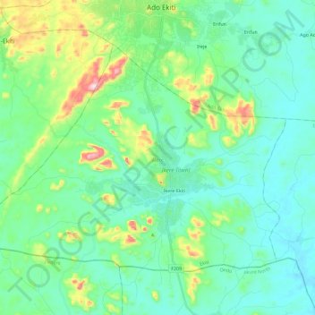
Name: Ikere topographic map, elevation, terrain.
Location: Ikere, Ekiti State, Nigeria (7.43344 5.08475 7.59626 5.31302)
Average elevation: 407 m
Minimum elevation: 318 m
Maximum elevation: 733 m
Thank you for supporting this site ❤️
Make a donation
Make a donation
Other topographic maps
Click on a map to view its topography, its elevation and its terrain.