
Thank you for supporting this site ❤️
Make a donation
Make a donation
Alamo Village topographic map
Click on the map to display elevation.
Thank you for supporting this site ❤️
Make a donation
Make a donation
About this map
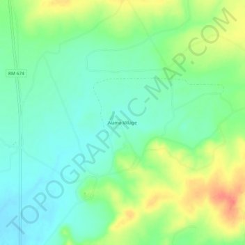
Name: Alamo Village topographic map, elevation, terrain.
Location: Alamo Village, Kinney County, Texas, United States (29.40801 -100.41508 29.44801 -100.37508)
Average elevation: 395 m
Minimum elevation: 376 m
Maximum elevation: 428 m
Thank you for supporting this site ❤️
Make a donation
Make a donation
Other topographic maps
Click on a map to view its topography, its elevation and its terrain.