
Bayo topographic map
Click on the map to display elevation.
Bayo
Bayo LGA is located at an elevation of 2,500 feet above sea level and has a total size of 956 square kilometers. The terrain of the Bayo local government region, which is part of the Savannah belt, is made up of hills and other rock formations. The area's temperature is reported to be 33 degrees Celsius, with a 13% humidity level.
About this map
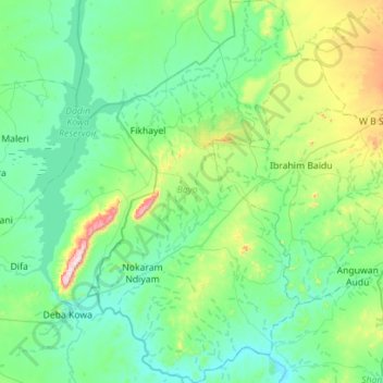
Name: Bayo topographic map, elevation, terrain.
Location: Bayo, Borno State, Nigeria (10.18975 11.52934 10.74126 11.83976)
Average elevation: 314 m
Minimum elevation: 196 m
Maximum elevation: 880 m