
Thank you for supporting this site ❤️
Make a donation
Make a donation
Broadwell topographic map
Click on the map to display elevation.
Thank you for supporting this site ❤️
Make a donation
Make a donation
About this map
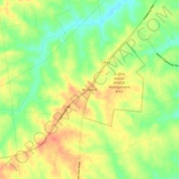
Name: Broadwell topographic map, elevation, terrain.
Location: Broadwell, Harrison County, Kentucky, United States (38.30869 -84.37910 38.34869 -84.33910)
Average elevation: 264 m
Minimum elevation: 237 m
Maximum elevation: 287 m
Thank you for supporting this site ❤️
Make a donation
Make a donation
Other topographic maps
Click on a map to view its topography, its elevation and its terrain.