
Thank you for supporting this site ❤️
Make a donation
Make a donation
Rutland topographic map
Click on the map to display elevation.
Thank you for supporting this site ❤️
Make a donation
Make a donation
About this map
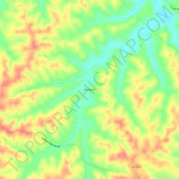
Name: Rutland topographic map, elevation, terrain.
Location: Rutland, Harrison County, Kentucky, United States (38.42480 -84.47077 38.46480 -84.43077)
Average elevation: 256 m
Minimum elevation: 222 m
Maximum elevation: 287 m
Thank you for supporting this site ❤️
Make a donation
Make a donation
Other topographic maps
Click on a map to view its topography, its elevation and its terrain.