
Mobile County topographic map
Interactive map
Click on the map to display elevation.
About this map
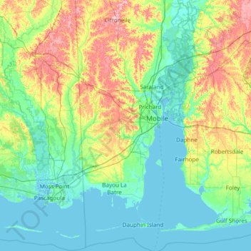
Name: Mobile County topographic map, elevation, terrain.
Location: Mobile County, Alabama, United States (30.14338 -88.43201 31.17337 -87.92420)
Average elevation: 25 m
Minimum elevation: -3 m
Maximum elevation: 110 m
Other topographic maps
Click on a map to view its topography, its elevation and its terrain.