
Thank you for supporting this site ❤️
Make a donation
Make a donation
Oberwintersbach (Geishöhe) topographic map
Click on the map to display elevation.
Thank you for supporting this site ❤️
Make a donation
Make a donation
Oberwintersbach (Geishöhe)
Oberwintersbach liegt auf dem 521 m ü. NHN hohen Berg Geishöhe, südlich von Wintersbach, direkt an der Grenze zum Landkreis Miltenberg. Im Westen fällt das Tal des Rosselbrunngrabens, mit dem Schloss Oberaulenbach, steil ab. Östlich befindet sich Oberkrausenbach. Im Südwesten und Südosten liegen Wildenstein, Wildenthal und Wildensee.
Thank you for supporting this site ❤️
Make a donation
Make a donation
About this map
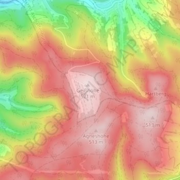
Name: Oberwintersbach (Geishöhe) topographic map, elevation, terrain.
Average elevation: 398 m
Minimum elevation: 194 m
Maximum elevation: 521 m
Thank you for supporting this site ❤️
Make a donation
Make a donation