
飞来寺观景台 topographic map
Interactive map
Click on the map to display elevation.
About this map
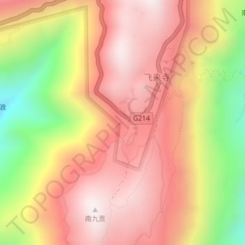
Name: 飞来寺观景台 topographic map, elevation, terrain.
Location: 飞来寺观景台, G214, 南任, 升平镇, 德钦县, 迪庆藏族自治州, 云南省, 中国 (28.44116 98.87591 28.44126 98.87601)
Average elevation: 3,267 m
Minimum elevation: 2,726 m
Maximum elevation: 3,607 m