
Thank you for supporting this site ❤️
Make a donation
Make a donation
Look Rock topographic map
Click on the map to display elevation.
Thank you for supporting this site ❤️
Make a donation
Make a donation
About this map
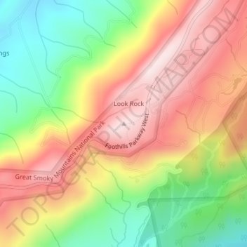
Name: Look Rock topographic map, elevation, terrain.
Location: Look Rock, Blount County, Tennessee, 37878, United States (35.63340 -83.94159 35.63350 -83.94149)
Average elevation: 597 m
Minimum elevation: 380 m
Maximum elevation: 796 m
Thank you for supporting this site ❤️
Make a donation
Make a donation
Other topographic maps
Click on a map to view its topography, its elevation and its terrain.