
Thank you for supporting this site ❤️
Make a donation
Make a donation
Banepa topographic map
Click on the map to display elevation.
Thank you for supporting this site ❤️
Make a donation
Make a donation
About this map
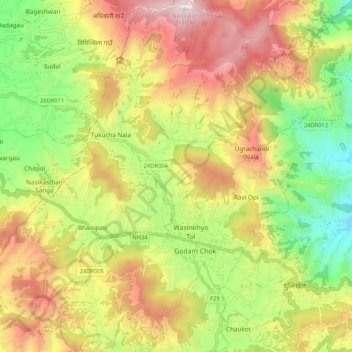
Name: Banepa topographic map, elevation, terrain.
Location: Banepa, Kavrepalanchok, Bagmati Pradesh, Nepal (27.60104 85.46028 27.69437 85.56474)
Average elevation: 1,559 m
Minimum elevation: 1,036 m
Maximum elevation: 2,145 m
Thank you for supporting this site ❤️
Make a donation
Make a donation