
Thank you for supporting this site ❤️
Make a donation
Make a donation
Ganeshpuri topographic map
Click on the map to display elevation.
Thank you for supporting this site ❤️
Make a donation
Make a donation
About this map
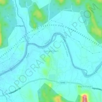
Name: Ganeshpuri topographic map, elevation, terrain.
Location: Ganeshpuri, Bhiwandi Taluka, Thane, Maharashtra, 401204, India (19.48072 72.99348 19.52072 73.03348)
Average elevation: 24 m
Minimum elevation: 2 m
Maximum elevation: 163 m
Thank you for supporting this site ❤️
Make a donation
Make a donation
Other topographic maps
Click on a map to view its topography, its elevation and its terrain.