
Thank you for supporting this site ❤️
Make a donation
Make a donation
Sechtem topographic map
Click on the map to display elevation.
Thank you for supporting this site ❤️
Make a donation
Make a donation
About this map
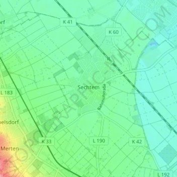
Name: Sechtem topographic map, elevation, terrain.
Average elevation: 67 m
Minimum elevation: 46 m
Maximum elevation: 131 m
Thank you for supporting this site ❤️
Make a donation
Make a donation
Other topographic maps
Click on a map to view its topography, its elevation and its terrain.
An der Roisdorfer Hufebahn
Deutschland > Nordrhein-Westfalen > Rhein-Sieg-Kreis > Bornheim
Average elevation: 128 m
Thank you for supporting this site ❤️
Make a donation
Make a donation
Üllekoven
Deutschland > Nordrhein-Westfalen > Rhein-Sieg-Kreis > Bornheim > Waldorf
Average elevation: 124 m