
Thank you for supporting this site ❤️
Make a donation
Make a donation
Watertown topographic map
Click on the map to display elevation.
Thank you for supporting this site ❤️
Make a donation
Make a donation
About this map
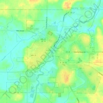
Name: Watertown topographic map, elevation, terrain.
Location: Watertown, Carver County, Minnesota, United States (44.94869 -93.86923 44.97786 -93.81849)
Average elevation: 291 m
Minimum elevation: 278 m
Maximum elevation: 309 m
Thank you for supporting this site ❤️
Make a donation
Make a donation
Other topographic maps
Click on a map to view its topography, its elevation and its terrain.