Geolocate
👉 Easily get elevation data in JSON, GeoTIFF and KML formats using Elevation API
Thank you for supporting this site ❤️
Make a donation

Imota topographic map

Click on the map to display elevation.

👉 Easily get elevation data in JSON, GeoTIFF and KML formats using Elevation API
Thank you for supporting this site ❤️
Make a donation

About this map

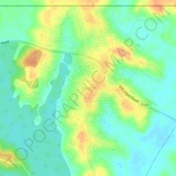
Name: Imota topographic map, elevation, terrain.

Location: Imota, Ikorodu, Lagos, Nigeria (6.64362 3.64945 6.68362 3.68945)

Average elevation: 18 m

Minimum elevation: 2 m

Maximum elevation: 41 m