
Thank you for supporting this site ❤️
Make a donation
Make a donation
Leiferde topographic map
Click on the map to display elevation.
Thank you for supporting this site ❤️
Make a donation
Make a donation
Leiferde
Die Gemarkung Leiferde erstreckt sich auf einer eiszeitlichen Dünenformation zwischen Aller- und Okerurstromtal. Aus diesem Grund gibt es mehrere kleine Anhöhen (Karberg, Eggelingsberg) und sumpfige Moorlagen.
Thank you for supporting this site ❤️
Make a donation
Make a donation
About this map
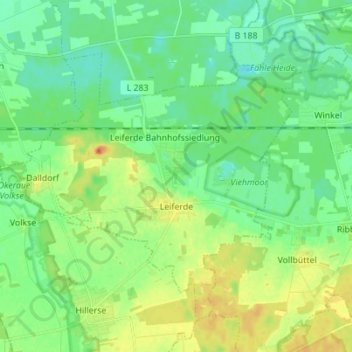
Name: Leiferde topographic map, elevation, terrain.
Average elevation: 59 m
Minimum elevation: 45 m
Maximum elevation: 86 m
Thank you for supporting this site ❤️
Make a donation
Make a donation