
Thank you for supporting this site ❤️
Make a donation
Make a donation
Pierpont topographic map
Click on the map to display elevation.
Thank you for supporting this site ❤️
Make a donation
Make a donation
About this map
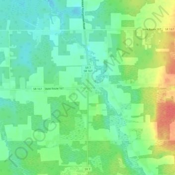
Name: Pierpont topographic map, elevation, terrain.
Location: Pierpont, Ashtabula County, Ohio, 44082, United States (41.72922 -80.58841 41.76922 -80.54841)
Average elevation: 307 m
Minimum elevation: 286 m
Maximum elevation: 339 m
Thank you for supporting this site ❤️
Make a donation
Make a donation
Other topographic maps
Click on a map to view its topography, its elevation and its terrain.
Thank you for supporting this site ❤️
Make a donation
Make a donation
Thank you for supporting this site ❤️
Make a donation
Make a donation