
Thank you for supporting this site ❤️
Make a donation
Make a donation
Bethlehem topographic map
Click on the map to display elevation.
Thank you for supporting this site ❤️
Make a donation
Make a donation
About this map
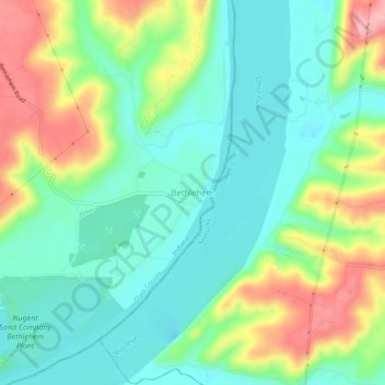
Name: Bethlehem topographic map, elevation, terrain.
Location: Bethlehem, Clark County, Indiana, 47104, United States (38.51923 -85.44051 38.55923 -85.40051)
Average elevation: 170 m
Minimum elevation: 124 m
Maximum elevation: 258 m
Thank you for supporting this site ❤️
Make a donation
Make a donation
Other topographic maps
Click on a map to view its topography, its elevation and its terrain.