
Nachanbor topographic map
Click on the map to display elevation.
About this map
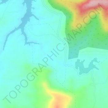
Name: Nachanbor topographic map, elevation, terrain.
Location: Nachanbor, Mhow Tahsil, Indore District, Madhya Pradesh, India (22.37850 75.75132 22.39378 75.76948)
Average elevation: 654 m
Minimum elevation: 602 m
Maximum elevation: 800 m