
Thank you for supporting this site ❤️
Make a donation
Make a donation
Hiawassee topographic map
Click on the map to display elevation.
Thank you for supporting this site ❤️
Make a donation
Make a donation
About this map
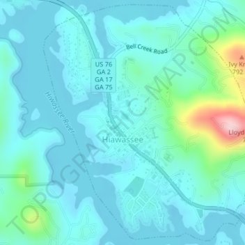
Name: Hiawassee topographic map, elevation, terrain.
Location: Hiawassee, Towns County, Georgia, United States (34.93679 -83.76766 34.96284 -83.73950)
Average elevation: 620 m
Minimum elevation: 581 m
Maximum elevation: 843 m
Thank you for supporting this site ❤️
Make a donation
Make a donation