
Lores topographic map
Interactive map
Click on the map to display elevation.
About this map
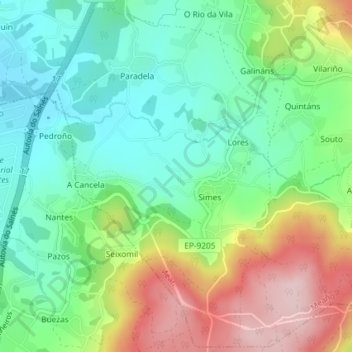
Name: Lores topographic map, elevation, terrain.
Location: Lores, Meaño, Salnés, Pontevedra, Galicia, 36969, España (42.41756 -8.80185 42.44374 -8.77767)
Average elevation: 104 m
Minimum elevation: 14 m
Maximum elevation: 262 m
Other topographic maps
Click on a map to view its topography, its elevation and its terrain.