
Thank you for supporting this site ❤️
Make a donation
Make a donation
Beaver topographic map
Click on the map to display elevation.
Thank you for supporting this site ❤️
Make a donation
Make a donation
About this map
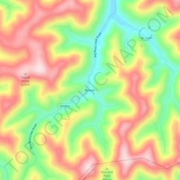
Name: Beaver topographic map, elevation, terrain.
Location: Beaver, Floyd County, Kentucky, 41660, United States (37.37677 -82.67432 37.41677 -82.63432)
Average elevation: 443 m
Minimum elevation: 264 m
Maximum elevation: 610 m
Thank you for supporting this site ❤️
Make a donation
Make a donation
Other topographic maps
Click on a map to view its topography, its elevation and its terrain.