
Thank you for supporting this site ❤️
Make a donation
Make a donation
Tamworth topographic map
Click on the map to display elevation.
Thank you for supporting this site ❤️
Make a donation
Make a donation
About this map
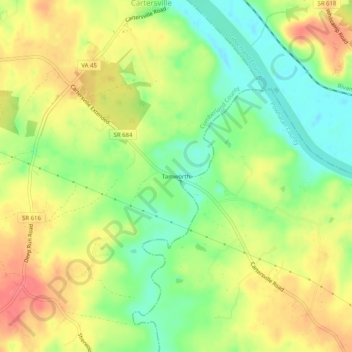
Name: Tamworth topographic map, elevation, terrain.
Location: Tamworth, Cumberland County, Virginia, 23027, United States (37.62760 -78.10477 37.66760 -78.06477)
Average elevation: 81 m
Minimum elevation: 48 m
Maximum elevation: 113 m
Thank you for supporting this site ❤️
Make a donation
Make a donation
Other topographic maps
Click on a map to view its topography, its elevation and its terrain.