
Marib Governorate topographic map
Interactive map
Click on the map to display elevation.
Marib Governorate
The governorate's climate varies based on elevation. The mountainous and elevated regions, which make up the western half of the governorate, are dominated by a moderate climate with hot summers and relatively cold winters. In the low-lying and plain regions, the climate is hot in the summers and moderate in the winters. The desert regions are characterized by a dry climate: hot in the summers, and cold and dry in the winters.
About this map
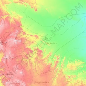
Name: Marib Governorate topographic map, elevation, terrain.
Location: Marib Governorate, Yemen (14.50398 44.52069 16.16188 46.81083)
Average elevation: 1,527 m
Minimum elevation: 856 m
Maximum elevation: 3,319 m
Other topographic maps
Click on a map to view its topography, its elevation and its terrain.