
Thank you for supporting this site ❤️
Make a donation
Make a donation
Branchville topographic map
Click on the map to display elevation.
Thank you for supporting this site ❤️
Make a donation
Make a donation
About this map
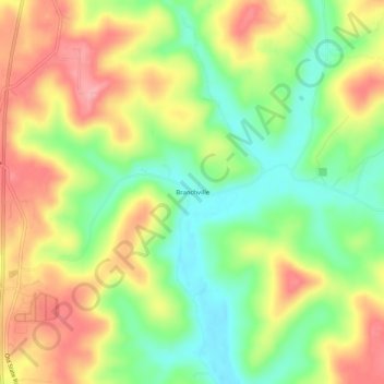
Name: Branchville topographic map, elevation, terrain.
Location: Branchville, Perry County, Indiana, 47514, United States (38.14367 -86.59971 38.18367 -86.55971)
Average elevation: 180 m
Minimum elevation: 123 m
Maximum elevation: 242 m
Thank you for supporting this site ❤️
Make a donation
Make a donation
Other topographic maps
Click on a map to view its topography, its elevation and its terrain.