
Thank you for supporting this site ❤️
Make a donation
Make a donation
Point O'Rocks topographic map
Click on the map to display elevation.
Thank you for supporting this site ❤️
Make a donation
Make a donation
About this map
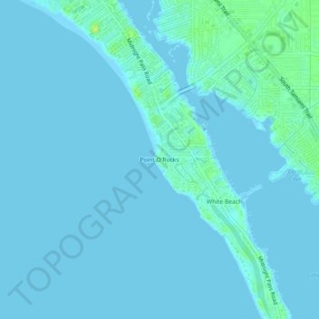
Name: Point O'Rocks topographic map, elevation, terrain.
Average elevation: 2 m
Minimum elevation: -2 m
Maximum elevation: 15 m
Thank you for supporting this site ❤️
Make a donation
Make a donation
Other topographic maps
Click on a map to view its topography, its elevation and its terrain.
Gulf Gate Estates
United States > Florida > Sarasota County > Gulf Gate Estates
Average elevation: 7 m
Thank you for supporting this site ❤️
Make a donation
Make a donation
Thank you for supporting this site ❤️
Make a donation
Make a donation
Ridge Wood Heights
United States > Florida > Sarasota County > Ridge Wood Heights
Average elevation: 10 m
Thank you for supporting this site ❤️
Make a donation
Make a donation