
Thank you for supporting this site ❤️
Make a donation
Make a donation
Vanderburgh County topographic map
Click on the map to display elevation.
Thank you for supporting this site ❤️
Make a donation
Make a donation
About this map
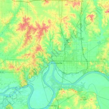
Name: Vanderburgh County topographic map, elevation, terrain.
Location: Vanderburgh County, Indiana, United States (37.82604 -87.70047 38.16842 -87.44941)
Average elevation: 127 m
Minimum elevation: 102 m
Maximum elevation: 188 m
Thank you for supporting this site ❤️
Make a donation
Make a donation
Other topographic maps
Click on a map to view its topography, its elevation and its terrain.