
Thank you for supporting this site ❤️
Make a donation
Make a donation
Coula topographic map
Click on the map to display elevation.
Thank you for supporting this site ❤️
Make a donation
Make a donation
About this map
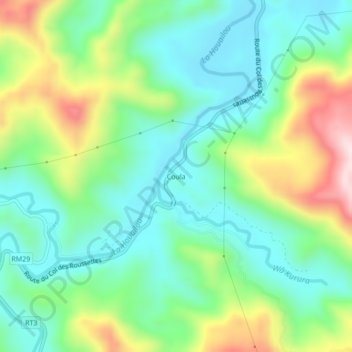
Name: Coula topographic map, elevation, terrain.
Location: Coula, Houaïlou, Province Nord, Nouvelle-Calédonie, France (-21.35255 165.42531 -21.31255 165.46531)
Average elevation: 155 m
Minimum elevation: 27 m
Maximum elevation: 432 m
Thank you for supporting this site ❤️
Make a donation
Make a donation