
Buol topographic map
Interactive map
Click on the map to display elevation.
About this map
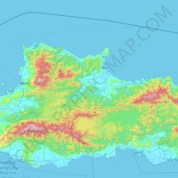
Name: Buol topographic map, elevation, terrain.
Location: Buol, Central Sulawesi, Sulawesi, 94564, Indonesia (0.67865 120.84790 1.31217 122.19572)
Average elevation: 235 m
Minimum elevation: -1 m
Maximum elevation: 2,387 m
Other topographic maps
Click on a map to view its topography, its elevation and its terrain.