
Thank you for supporting this site ❤️
Make a donation
Make a donation
Sigodu topographic map
Click on the map to display elevation.
Thank you for supporting this site ❤️
Make a donation
Make a donation
About this map
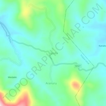
Name: Sigodu topographic map, elevation, terrain.
Location: Sigodu, Koppa taluk, Chikkamagaluru, Karnataka, 577112, India (13.32940 75.40922 13.36940 75.44922)
Average elevation: 801 m
Minimum elevation: 722 m
Maximum elevation: 1,061 m
Thank you for supporting this site ❤️
Make a donation
Make a donation
Other topographic maps
Click on a map to view its topography, its elevation and its terrain.