
Thank you for supporting this site ❤️
Make a donation
Make a donation
Irepodun topographic map
Click on the map to display elevation.
Thank you for supporting this site ❤️
Make a donation
Make a donation
About this map
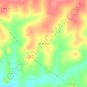
Name: Irepodun topographic map, elevation, terrain.
Location: Irepodun, Atiba, Oyo State, Nigeria (8.03046 3.79740 8.07046 3.83740)
Average elevation: 273 m
Minimum elevation: 231 m
Maximum elevation: 308 m
Thank you for supporting this site ❤️
Make a donation
Make a donation