
Llanthony topographic map
Interactive map
Click on the map to display elevation.
About this map
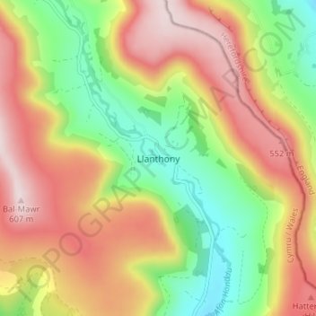
Name: Llanthony topographic map, elevation, terrain.
Location: Llanthony, Monmouthshire, Wales, NP7 7NN, Verenigd Koninkrijk (51.92261 -3.05850 51.96261 -3.01850)
Average elevation: 392 m
Minimum elevation: 184 m
Maximum elevation: 606 m