
Thank you for supporting this site ❤️
Make a donation
Make a donation
Westwater topographic map
Click on the map to display elevation.
Thank you for supporting this site ❤️
Make a donation
Make a donation
About this map
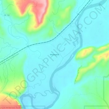
Name: Westwater topographic map, elevation, terrain.
Location: Westwater, Grand County, Utah, United States (39.05832 -109.13233 39.09832 -109.09233)
Average elevation: 1,349 m
Minimum elevation: 1,307 m
Maximum elevation: 1,507 m
Thank you for supporting this site ❤️
Make a donation
Make a donation
Other topographic maps
Click on a map to view its topography, its elevation and its terrain.