
Koekelberg topographic map
Interactive map
Click on the map to display elevation.
About this map
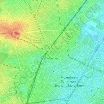
Name: Koekelberg topographic map, elevation, terrain.
Location: Koekelberg, Brussels Hoofdstedelijk Gewest, 1081, België (50.85678 4.30690 50.86759 4.33773)
Average elevation: 35 m
Minimum elevation: 14 m
Maximum elevation: 72 m