
Thank you for supporting this site ❤️
Make a donation
Make a donation
Denderleeuw topographic map
Click on the map to display elevation.
Thank you for supporting this site ❤️
Make a donation
Make a donation
About this map
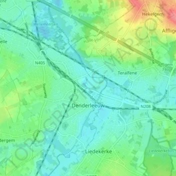
Name: Denderleeuw topographic map, elevation, terrain.
Location: Denderleeuw, Aalst, East Flanders, Flanders, Belgium (50.86453 4.02866 50.91165 4.08965)
Average elevation: 21 m
Minimum elevation: 3 m
Maximum elevation: 67 m
Thank you for supporting this site ❤️
Make a donation
Make a donation