
Serro Ventoso topographic map
Interactive map
Click on the map to display elevation.
About this map
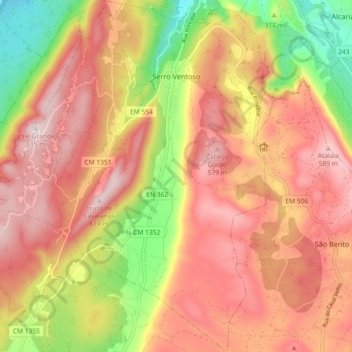
Name: Serro Ventoso topographic map, elevation, terrain.
Location: Serro Ventoso, Porto de Mós, Leiria, Centro, Portugal (39.50503 -8.88917 39.57551 -8.80538)
Average elevation: 417 m
Minimum elevation: 137 m
Maximum elevation: 612 m
Other topographic maps
Click on a map to view its topography, its elevation and its terrain.
Paiã
Portugal > Centro > Porto de Mós > Paiã
Paiã, São Bento, Porto de Mós, Leiria, Pinhal Litoral, Centro, 2835-333, Portugal
Average elevation: 293 m
Alvados
Portugal > Centro > Porto de Mós > Alvados
Alvados, Porto de Mós, Leiria, Pinhal Litoral, Centro, 2480-032, Portugal
Average elevation: 375 m