
Thank you for supporting this site ❤️
Make a donation
Make a donation
Double Island topographic map
Click on the map to display elevation.
Thank you for supporting this site ❤️
Make a donation
Make a donation
About this map
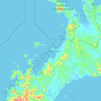
Name: Double Island topographic map, elevation, terrain.
Location: Double Island, Roxas, Palawan, Mimaropa, Philippines (10.21334 118.90960 10.85334 119.54960)
Average elevation: 52 m
Minimum elevation: -3 m
Maximum elevation: 1,010 m
Thank you for supporting this site ❤️
Make a donation
Make a donation
Other topographic maps
Click on a map to view its topography, its elevation and its terrain.