
Bayside topographic map
Interactive map
Click on the map to display elevation.
About this map
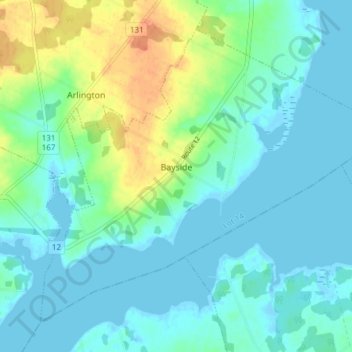
Name: Bayside topographic map, elevation, terrain.
Location: Bayside, Lot 14, Prince County, Prince Edward Island, Canada (46.49535 -63.92143 46.53905 -63.84531)
Average elevation: 11 m
Minimum elevation: -3 m
Maximum elevation: 41 m
Other topographic maps
Click on a map to view its topography, its elevation and its terrain.
Grand River
Canada > Prince Edward Island > Lot 14
Grand River, Lot 14, Prince County, Prince Edward Island, Canada
Average elevation: 17 m