
Thank you for supporting this site ❤️
Make a donation
Make a donation
Orange County topographic map
Click on the map to display elevation.
Thank you for supporting this site ❤️
Make a donation
Make a donation
About this map
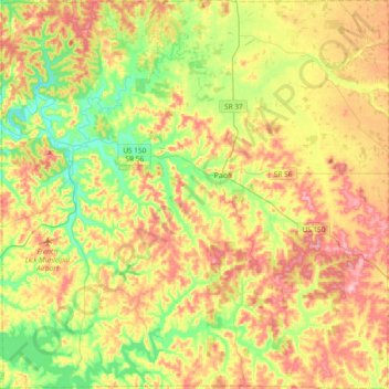
Name: Orange County topographic map, elevation, terrain.
Location: Orange County, Indiana, United States (38.39407 -86.68310 38.68866 -86.30760)
Average elevation: 210 m
Minimum elevation: 139 m
Maximum elevation: 295 m
Thank you for supporting this site ❤️
Make a donation
Make a donation
Other topographic maps
Click on a map to view its topography, its elevation and its terrain.