
Thank you for supporting this site ❤️
Make a donation
Make a donation
Loch Lynn Heights topographic map
Click on the map to display elevation.
Thank you for supporting this site ❤️
Make a donation
Make a donation
About this map
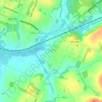
Name: Loch Lynn Heights topographic map, elevation, terrain.
Location: Loch Lynn Heights, Garrett County, Maryland, United States (39.38626 -79.38157 39.39672 -79.36566)
Average elevation: 747 m
Minimum elevation: 723 m
Maximum elevation: 795 m
Thank you for supporting this site ❤️
Make a donation
Make a donation
Other topographic maps
Click on a map to view its topography, its elevation and its terrain.