
Thank you for supporting this site ❤️
Make a donation
Make a donation
Red Hill topographic map
Click on the map to display elevation.
Thank you for supporting this site ❤️
Make a donation
Make a donation
About this map
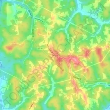
Name: Red Hill topographic map, elevation, terrain.
Location: Red Hill, Wood County, West Virginia, 26142, United States (39.22785 -81.49401 39.26785 -81.45401)
Average elevation: 243 m
Minimum elevation: 191 m
Maximum elevation: 308 m
Thank you for supporting this site ❤️
Make a donation
Make a donation
Other topographic maps
Click on a map to view its topography, its elevation and its terrain.