
Thank you for supporting this site ❤️
Make a donation
Make a donation
Nahuta topographic map
Click on the map to display elevation.
Thank you for supporting this site ❤️
Make a donation
Make a donation
About this map
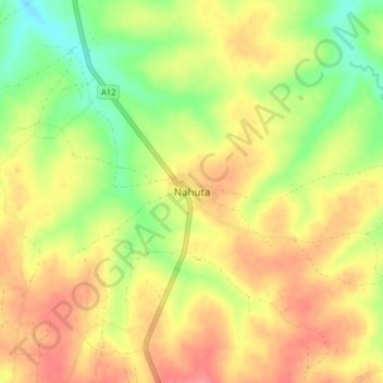
Name: Nahuta topographic map, elevation, terrain.
Location: Nahuta, Bali, Taraba State, Nigeria (8.01818 10.97347 8.09818 11.05347)
Average elevation: 205 m
Minimum elevation: 166 m
Maximum elevation: 237 m
Thank you for supporting this site ❤️
Make a donation
Make a donation