
Thank you for supporting this site ❤️
Make a donation
Make a donation
Allegany topographic map
Click on the map to display elevation.
Thank you for supporting this site ❤️
Make a donation
Make a donation
About this map
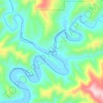
Name: Allegany topographic map, elevation, terrain.
Location: Allegany, Coos County, Oregon, United States (43.40601 -124.05210 43.44601 -124.01210)
Average elevation: 118 m
Minimum elevation: -2 m
Maximum elevation: 440 m
Thank you for supporting this site ❤️
Make a donation
Make a donation
Other topographic maps
Click on a map to view its topography, its elevation and its terrain.