
Thank you for supporting this site ❤️
Make a donation
Make a donation
Helmsburg topographic map
Click on the map to display elevation.
Thank you for supporting this site ❤️
Make a donation
Make a donation
About this map
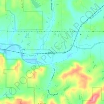
Name: Helmsburg topographic map, elevation, terrain.
Location: Helmsburg, Brown County, Indiana, 47435, United States (39.24529 -86.31308 39.28529 -86.27308)
Average elevation: 222 m
Minimum elevation: 190 m
Maximum elevation: 292 m
Thank you for supporting this site ❤️
Make a donation
Make a donation