
Thank you for supporting this site ❤️
Make a donation
Make a donation
Prim topographic map
Click on the map to display elevation.
Thank you for supporting this site ❤️
Make a donation
Make a donation
About this map
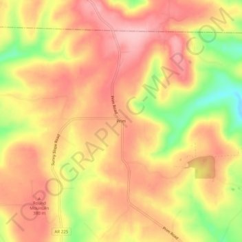
Name: Prim topographic map, elevation, terrain.
Location: Prim, Cleburne County, Arkansas, 72130, United States (35.67397 -92.12848 35.71397 -92.08848)
Average elevation: 353 m
Minimum elevation: 258 m
Maximum elevation: 406 m
Thank you for supporting this site ❤️
Make a donation
Make a donation
Other topographic maps
Click on a map to view its topography, its elevation and its terrain.