Geolocate
👉 Easily get elevation data in JSON, GeoTIFF and KML formats using Elevation API
Thank you for supporting this site ❤️
Make a donation

Ilora topographic map

Click on the map to display elevation.

👉 Easily get elevation data in JSON, GeoTIFF and KML formats using Elevation API
Thank you for supporting this site ❤️
Make a donation

About this map

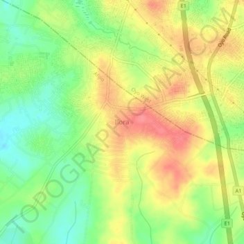
Name: Ilora topographic map, elevation, terrain.

Location: Ilora, Afijio, Oyo State, Nigeria (7.78000 3.88000 7.82000 3.92000)

Average elevation: 294 m

Minimum elevation: 258 m

Maximum elevation: 329 m