
Granite Peak topographic map
Interactive map
Click on the map to display elevation.
About this map
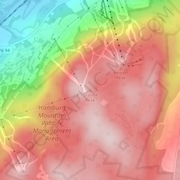
Name: Granite Peak topographic map, elevation, terrain.
Location: Granite Peak, Sussex County, New Jersey, 07472, USA (41.17623 -74.50939 41.17633 -74.50929)
Average elevation: 332 m
Minimum elevation: 123 m
Maximum elevation: 449 m
Other topographic maps
Click on a map to view its topography, its elevation and its terrain.