
Jugån topographic map
Interactive map
Click on the map to display elevation.
About this map
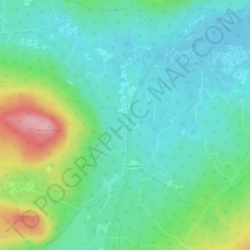
Name: Jugån topographic map, elevation, terrain.
Location: Jugån, Mora, Provinz Dalarna, Landesteil Svealand, Schweden (60.88343 14.37307 60.89205 14.37498)
Average elevation: 249 m
Minimum elevation: 208 m
Maximum elevation: 362 m
Other topographic maps
Click on a map to view its topography, its elevation and its terrain.
Storsätern
Schweden > Provinz Dalarna > Storsätern
Storsätern, Älvdalens kommun, Provinz Dalarna, Landesteil Svealand, 79091, Schweden
Average elevation: 748 m