
Thank you for supporting this site ❤️
Make a donation
Make a donation
Annur topographic map
Click on the map to display elevation.
Thank you for supporting this site ❤️
Make a donation
Make a donation
Annur
Annur is located at 11°14′N 77°08′E / 11.23°N 77.13°E / 11.23; 77.13.[4] It has an average elevation of 338 metres (1108 feet). Annur is well connected by roads including the National Highway 209 (New NH948) (Coimbatore to Bangalore highway) and the State Highway 80 SH80 Avanashi to Mettupalayam passes through Annur.
Thank you for supporting this site ❤️
Make a donation
Make a donation
About this map
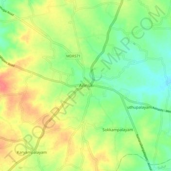
Name: Annur topographic map, elevation, terrain.
Average elevation: 381 m
Minimum elevation: 356 m
Maximum elevation: 412 m
Thank you for supporting this site ❤️
Make a donation
Make a donation
Other topographic maps
Click on a map to view its topography, its elevation and its terrain.